Showing posts with label Nature. Show all posts

Nizamabad | Tourism | Sriramsagar

Travel Guide

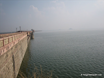
Sriramsagar is around 200km from Hyderabad in Nizamabad district, Telangana. The entire stretch of 200km drive from Hyderabad to Sriramsagar is on the NH7 which is in very good condition.

Profile

Sriramsagar, also known as the Pochampadu Project, is an irrigation project across river Godavari in Telangana to serve irrigational needs in Karimnagar, Warangal, Adilabad, Nalgonda, and Khammam districts. It has been truly described as a "lifeline for Telangana" as it caters to both irrigational and drinking needs of larger part of Telangana.

Sri Rama Sagar Reservoir's capacity is 75 billion cubic feet, and it has 42 floodgates. It also includes Kakatiya Canal covering 284 km, Laxmi Canal, Sarswati Canal, and Flood flow canal. Most of the catchment area upstream of this dam is located in Maharashtra

The Kakatiya and Flood flow canal are interconnected with the Manair river/dam in Karimnagar district, to stabilize the ayacut under both Karimnagar and Warangal districts.

Route Map

<
View Larger Map

Karimnagar | Tourism | Ujwala Deer Park

Ujwala and Deer park are two nice hang out places in Karimnagar city amidst beautiful surroundings of Lower Manair Dam.

Adilabad | Tourism | Kuntala Waterfalls

Travel Guide

Kuntala waterfalls is around 250km from Hyderabad in the dense Sahyadri mountain range of Adilabad district. Nearest village is Neredigonda which is around 12kms from the waterfalls. The entire stretch of 240km drive from Hyderabad to Neredigonda is on the NH7 which is good.

Profile

Kuntala waterfall is located amidst the dense forest of the Sahayadri range of mountains. The beauty of this place enriches with the River Kanda that flows through the dense forest nearby. There are many big and small waterfalls formed by this river but at certain point, this river comes and falls from a height of 45 metres. This is where it is called as Kuntala waterfall.

It is one of the amazing and refreshing experiences to see as the water gushes out of the rocks and falls with a force that turns the water below to whirls. It is very enjoyable in the monsoon season when the water flows with all its vigour.

Very close to the Kuntala waterfall, there is a temple of Lord Someshwara Swami. This temple is situated in a beautiful where two hillocks slit to form a passage as the entrance to the temple. This is a temple of Lord Shiva. The locals offer daily rituals to the lord and on Mondays special puja is performed.

Every visitor who visits the waterfall makes sure to visit this ancient temple. On Maha Shivarathri this temple is beautifully decorated with flowers. Many devotees from local and nearby places visit this temple.

According to the popular and local's belief, Kuntala waterfall got its name after Shakuntala (the mother of Emperor Bharata after whose name the country (India) is called as "Bharat"), the beloved wife of King Dushyanth (the founder of Paurav Dynasty). The tale from the great mythology, Mahabharata, where the king Dushyanth falls in love with the forest beauty, is said to have taken place in this region. The locals believe that shakuntala used to have her bath in this waterfall. Therefore, this waterfall got the name as Kuntala waterfall after her name.

Anyone reaching this place from Hyderabad/Nizamabad side can also visit Sriramsagar Reservoir which is on the way besides NH7.

Route Map

<
View Larger Map

Nizamabad | Tourism | AliSagar

Travel Guide

Alisagar Reservoir is situated at a distance of 13Km from Nizamabad which is another important picnic spot, close to Nizamabad. A beautiful garden raised here attract picnickers from Nizamabad.

Profile

Alisagar is the beautiful garden developed by Nizam of Hyderabad. This is under the control of Irrigation Department as the Garden is under the bund of Alisagar Tank maintained by Irrigation Department. The Garden is in (33) acres with fountains and has lot of flowers, Deer Park, Tree House. The Garden is very poorly maintained due to insufficient funds and non-availability of technical no-how in garden maintenance. There is an island inside the Alisagar lake. Boating facility in the tank has been introduced recently. About 1000 to 2000 people visit the Alisagar garden on Sundays. Alisagar is situated about (10) K.Ms. away from the Nizamabad town and (2) K.Ms. from Nizamabad-Basar route.

Khammam | Tourism | Papi Kondalu

Travel Guide

Papi Kondalu is around 60Kms from Bhadrachalam. The actual distance varies depending on the boarding point. The popular boarding point is Kunavaram which is approximately around 55Kms from Bhadrachalam. Pochavaram, another important boarding point is around 75Kms from Bhadrachalam. People visiting in winter/summer has to go downstream to Pochavaram as water levels may be low at Kunavaram to ride boats. People coming from Rajamundry can board the boats at Pattiseema or Polavaram.

It is better to have your own transportation to reach these places from Bhadrachalam/Rajamundry, rather than depending of public transport. Alternatively, you can choose APTourism services which provides some special packages to visit this place. Don't forget to make your own food arrangements as you hardly get any good food nearby. The food served in the boats is also not up to the mark.


Profile

Papi Hills or Papi Kondalu (In Telugu language) is part of Eastern Ghats through which Godavari pierces and flows in twists and turns (called 'malupulu ' in telugu) towards east. Entire area of PapiKondalu is covered by tropical rain forests and deciduous rain forests.

The boat ride on Godavari via Papi Kondalu is a pleasant and memorable experience. It leads you to countryside patch-worked with tiny farm plots, the landscapes dotted with tribal habitations, the river banks forested with the timber reserves, the fresh air and the deep river all blend tighter to make it a magic place. They present ideal settings to enjoy the nature. The beauty of the uncrowned spaces all along the river makes people stop and stare. Actual Papi Kondalu is a place where the width of Godavari is Narrowest less than a KM). From distance you would feel that both the hills are merging together however the boat cruises through the narrow width of Godavari and this is the best of the entire trip.


Route Map


View Larger Map

Karimnagar | Tourism | Lower Manair Dam

Travel Guide

Lower Manair Dam is situated at the entry of the Karimnagar town while coming from Hyderabad/Warangal. It is at a distance of around 160Km from Hyderabad and 65Km from Warangal. Karimnagar is well connected by Road and Rail.

Profile

Lower Manair Dam (LMD), built on Manair river, a tributary to Godavari, is the lifeline of Karimnagar District. It is the most picturesque reservoir, which serves as good recreation spot for all, especially during weekends. You get a nice lush-green view of the Karimnagar town and its surroundings from the top of the dam. Boating here is a memorable experience. There is also a Deer Park and Ujwala Park on the downside of the dam which are nice hangout places for families.

The dam work started in 1974 and was completed by 1985. It has 20 gates and can store around 24 tmc of water. As per the records, the total irrigatable land under the dam is around 3 lakh acres. It is linked with SriramSagar Dam constructed on River Godavari via Kakatiya Canal which serves as a major source of water for the Dam and the people of Karimnagar.


Route Map


View Larger Map

Warangal | Tourism | Pakhal Lake

Travel Guide

Phakal is situaled about 50 kms east of Warangal and it is well connected by road passing through the east while taluk headquarter of Narsampet which about 12 kms away. There is frequent bus service from Warangal to this place.

Profile

Pakhal Lake, situated amidst undulating forest land hills and dales is a popular retreat for the tourists. The lake, constructed around 1213 A.D. by Kakatiyan Ruler, Ganapathidev and spread over an area of 30 Sq.Kms., provides a beautiful site.Set around the shores of this lake is the Pakhal Wild Life Sanctuary with an area of 839 sq.kms. It is a dense forest shelter for a variety of fauna.

If, one is lucky, one can spot a tiger or a leopard or a bear and one can find a herd of deer roaming about freely in the wild. The sanctuary is also harbouring Marmals like panthers, hyensa, wolf, wild dogs, jackals, sloth bear, nilgal, porcupine, langoor, Reptiles like python, cobra, common krait, monitor lizard and Crocodiles

Warangal | Tourism | Laknavaram Lake

Travel Guide

Laknavaram Lake lies within the limits of Laknavaram village in Govindaraopet mandal. This is adjacent to Mulug mandal.

By Road

Laknavaram Lake is around 78Km from Warangal. Tourists coming from Warangal direction has to take the NH 202 road towards Mulugu. After crossing mulugu, drive 8Km to the right direction into the thick forest to reach this place.

Laknavaram Lake is around 120Km from Karimnagar. It can be reached via Huzurabad/Parkal bypassing Warangal. Tourists have to take the Karimnagar-Warangal state Highway till Huzurabad(40Km from Karimnagar) and take left towards Parkal(30Km from Huzurabad). Follow the Bhoopalapally-Parkal road till Gandhinagar village(20Km from Parkal) and take a right. Join the NH202 near Mulugu(20Km). Laknavaram is another 8Km from there. The famous Ghanpur/Ramappa temples are on the way in this route.

By Rail

Nearest railway station is Kazipet/Warangal. This is a major railway junction. All important trains have a stop here.


Profile

The green hills of Govindaraopet agency mandal lie side by side to form a massive bowl like structure which holds the spacious, beautiful and pristine lake popular known as ‘Laknavaram Cheruvu’.

The lake was the discovery of ancient Kakatiya rulers. They spotted this excellent place amidst trees and green hills lined up around to hold the rainwater. The Kakatiya rulers only built a small sluice gate turning the place into a spacious lake which now feeds thousands of acres of agricultural land every year.


Route Map


View Larger Map

Visakhapatnam | Tourism | Araku Valley

Travel Guide

Araku is situated around 115 km from the Visakhapatnam city. The valley is even connected through rail from the city of Vishakapatnam. There are two railway stations at Araku and Araku Valley in the Kothavalasa-Kirandul railway line in Visakhapatnam division of East Coast Railway, Indian Railways.

Alternatively, Araku can be reached from Anakapalli via Paderu by road. The distance is same as from Vizaq. This road is single lane and not that good compared to Vizaq-Araku route. But, you will get a chance to see the beautiful country side of Visakha Agency amidst picturesque Eastern Ghats.

Borra caves, another popular tourism attraction, is located 29 km from Araku Valley.

Read more »

Nellore | Tourism | Pulicat Lake

Travel Guide

Pulicate Lake lies at the border of Tamil Nadu and Andhra Pradesh states. The barrier island of Sriharikota(India's only satellite launch center located in AndhraPradesh) separates the lake from the Bay of Bengal.

By Road

Pulicat Lake is around 60Km from Chennai & 100Km from Nellore. It is very near to Sullurpet, a small town in Nellore.

By Rail

Chennai & Nellore are major railway stations in the vicinity. Sullurpet is the nearest railway station and will server shorter if the trains have stop here.

Read more »

Visakhapatnam | Tourism | Borra Caves

Travel Guide

Borra Caves are located about 90kms north of Visakhapatnam, in the Ananthagiri hill ranges of Eastern Ghats. It is around 29Km from the famous Araku valley.

Read more »

Visakhapatnam | Tourism | RushiKonda Beach

Travel Guide

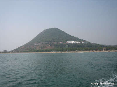
Rushikonda Beach is situated about 8 km away from the Visakhapatnam city. Visakhapatnam is a prominent city in Andhra Pradesh and well connected by Road, Rail & Air.

Read more »

Chittoor | Tourism | Talakona

Travel Guide

Talakona is around 54Kms from Tirupati and 9Kms from Nerabailu. This place is a bit interior. So, it is better to have your own transportation rather than depending of public transport. Alternatively, you can choose APTourism services which provides some special packages to visit this place.

Read more »

Chittoor | Tourism | Kalyani Dam

Travel Guide

Kalyani Dam is about 18 km from Tirupati, situated in the Rangampet forest on the Tirupati-Madanapallee Road of NH 205

Read more »